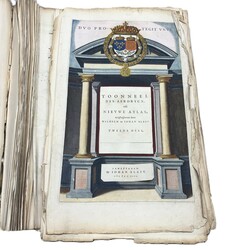
Kavel 493 Willem and Joan. Bleau, 'Toonneel des Aerdrijcx, ofte Nieuwe Atlas'. Amsterdam, tweede deel, 1642
| Kavel | 493. Willem and Joan. Bleau, 'Toonneel des Aerdrijcx, ofte Nieuwe Atlas'. Amsterdam, tweede deel, 1642 |
|---|---|
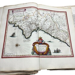
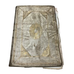
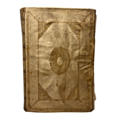
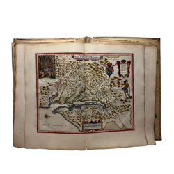
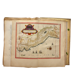
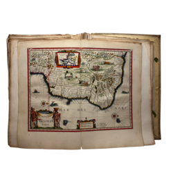
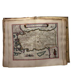
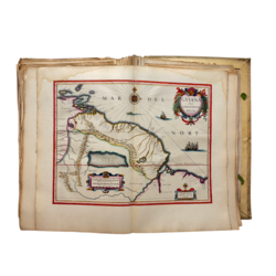
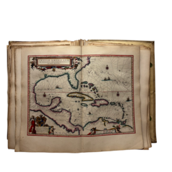
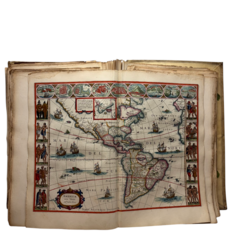
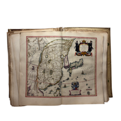
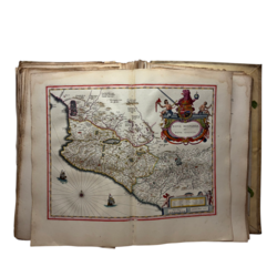
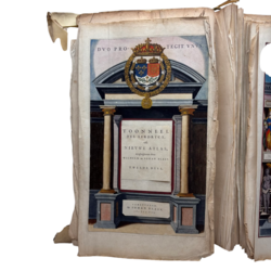
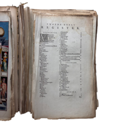
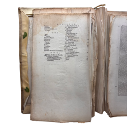
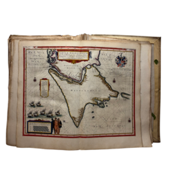
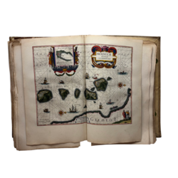
| Omschrijving | 17e eeuws boek, 'Toonneel des Aerdrycx, Oft Nieuwe Atlas, uytghegheven door Wilhelm en Iohan Blaeu', 1642. Tweede deel, eerste en tweede stuk, gebonden in perkamenten band, met in totaal 92 kopergravures, handgekleurde kaarten van Frankrijk, Spanje, Afrika, Azië en de Amerikas: Vrancrijck, Boulogne, Guines, en Oye, Camerijck, Picardien, Vermandois, en Capelle, Het Gouvernement van l’Ile de France, Valois, Beauvoisis, L’Isle de France, Brie, Beausse, Gastinois, en Senonois, Champagne, Rheims, en Rhetelois, Sedan, Raucourt, en Donchery, Lothringen, Metz, Burgundien, Charolois, Genever meer, Bresse, Dombes, Lyonnois, Forez, Beaujolois, en Masconnois, Limoges, en Limoine d’Auvergne, Bourbonnois, Nevers, Berry, Blaisois, en Perche, Touraine, Lodun, en Mirebelais, Anjou, Le Maine, Normandie, Bretaigne, Poictou, Xaintonge, Oleron, en S. Martin, Sarlat, Bordeaux, Bearn, Quercy, Languedoc, Provence, Orange, en Venaissin, Delphine, Savoye, Het rijck van Keiser Karel de Groote voor, Oudt Vrancrijck na de beschrijving van Strabo, en andere oude, Oudt Vrancrijck na de beschrijving van Iul. Caesar, Spaenien, Catalonien, Valentien, Arragon, Navarra, Biscaja, en Guipuscoa, Leon, en Asturius, Gallicia, Portugal, en Algarben, Castilien, en Extremadura, Granaden, en Murcia, Majorca, Minorca, en Yvica, Andalusien, Africa, Fez, en Marocco, Guinea, Abissinen, Neder Aethiopien, en Congo, Asia, Indien, Grooten Mogol, Moluccen, China, en Iapon, Tartariën, Persien, Turckyen, Cyprus, Natolia, Palestina, of ’t Landt van beloffen, America, ofte Nieuwe Wereldt, West-Indie Eylanden, Zuyder Virginia, Florida, Yucatan, Honduras, en Guatemala, Nieuw Nederlandt, en Nieuw Engelandt, Bermudas, Virginia, Florida, Nieuw Spaenjen, en Nieuw Galissien, Terra Firma, Nieuw Granaden, en Popayan, Nieuw Andalusien, en Venezuela, Guajana, ofte de Wilde Kust, Brasil, Rio de la Plata, ofte Paraguay, Tucuman, en S.ta Cruz de la Sierra, Straet Magellanes, Straet le Maire, en Magellanica, Chili, Peru. |
| Taxatiewaarde | € 8000 - € 12000 |
| Veiling | Sessie II - 24 maart 2026 |
| Afmetingen | 51,5 x 36,5 cm x 8 cm |
| Conditie | Perkamenten kaft in redelijke staat, kaarten zitten (grotendeels) los in boek. Kaarten over het algemeen in goede staat, lichte foxing op de buitenranden, enkele kaarten met vochtvlekken aan de bovenzijde, enkele kaarten met scheurtjes aan de onderzijde van de middenvouw. |
| Startbod | € 6000 |
| Verkocht voor | € 18000 |
| Vorig kavel | Volgend kavel |